The simple ways cities can adapt to heatwaves - BBC Future
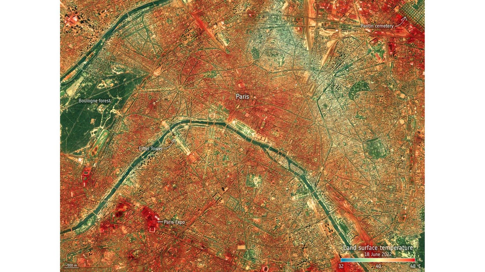
A heat map shows land surface temperatures in Paris during a heatwave in June 2022 (Credit: European Space Agency)
…
Satellite images reveal how green spaces, white roads and water features are helping keep cities cool during deadly heatwaves.
R
Ribbons of blue snake through the bird’s eye view of Prague, a cool relief from the intense patchwork of hot red, vivid orange, and bright yellow that dominates the satellite images.
The blue marks the Vltava River, offering cool respite to the Czech Republic’s capital from the blazing heatwave that hit the city in June 2022, while interspersed green patches symbolise parks, another relief from the hot land surface temperatures, which measured up to 45C (113F) last summer.
These are urban heat map images captured from space. They show the dramatic impact of green spaces, white road surfaces and water on cities, helping them cool in a natural way and resist the rise of deadly heat waves.
Mapping these extreme hotspots are a vital asset to city planners as the world warms up and heat-related deaths continue to rise. In 2022, more than 20,000 people died of heat-related causes in Europe, with temperatures in the UK surpassing 40C (104F) for the first time in history. In June this year, areas in Spain registered 44C (111F) on the thermometer – and city dwellers across the pond in the US aren’t faring much better. There have been at least 13 heat-related deaths in Texas over the past two weeks, as meteorologists predict the extreme heatwave will spread over the southern US, and that temperatures exceeding 43C (110F) will be commonplace.
Images that are constantly being captured by the International Space Station not only show extreme land surface temperatures in cities, but also dramatically cooler areas that are the result of having parks or water features in densely populated areas. One study found that neighbourhoods within a 10-minute walk of a park are as much as 3C cooler than areas outside that range.
▻https://www.esa.int/Applications/Observing_the_Earth/Copernicus/City_heat_extremes
#climat #temperature #urbanisme #cartographie #parcs_et_jardins #villes