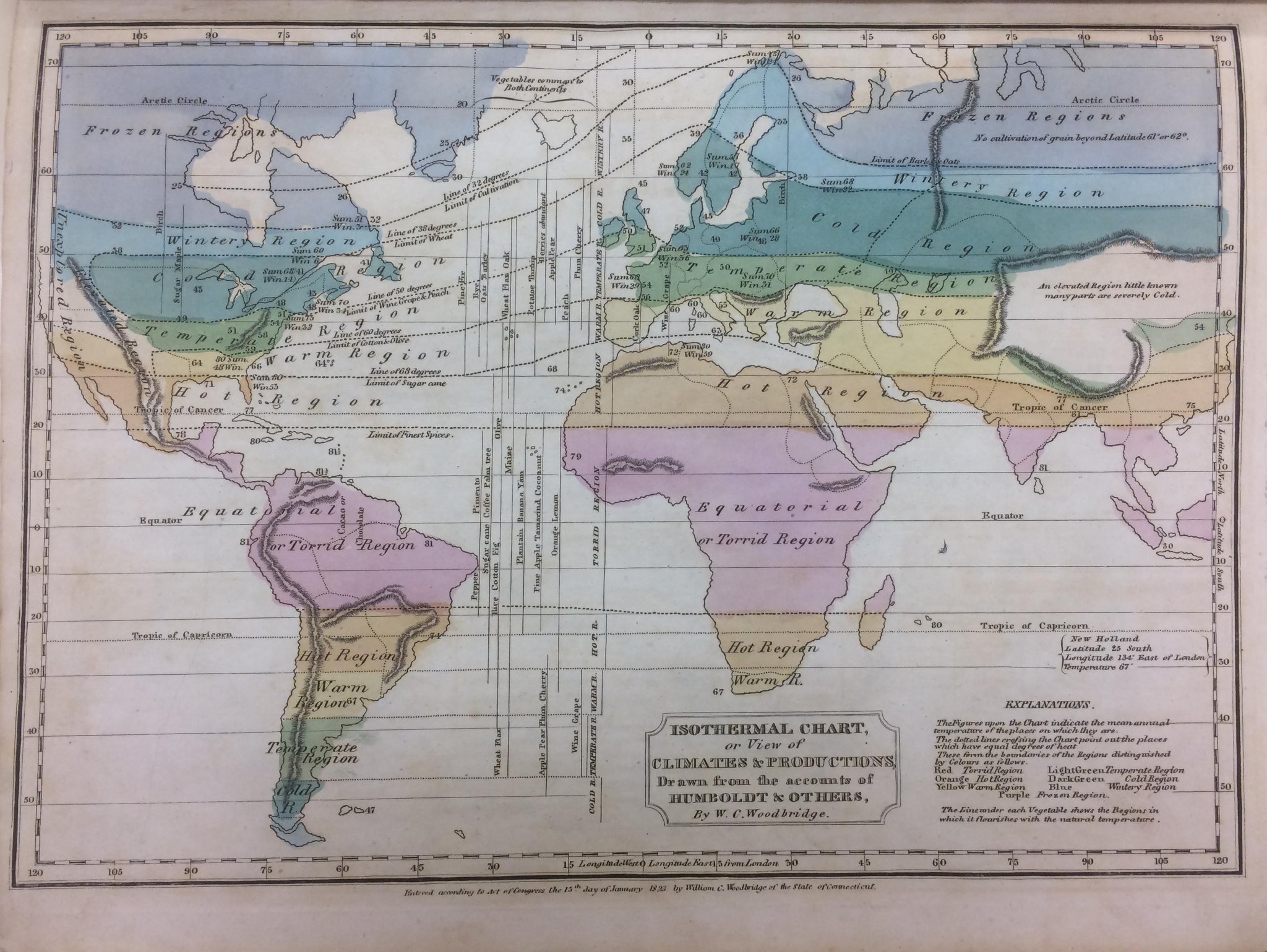
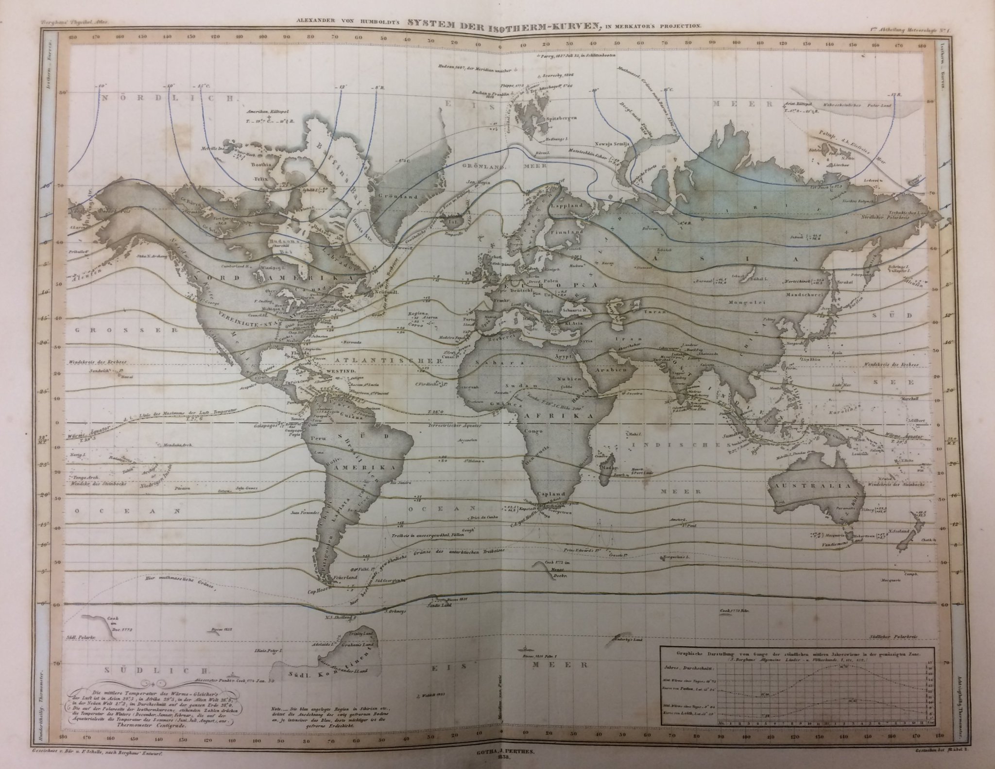
16th Century Historical Map by Urbano Monte Digitally Stitched Together
▻https://mymodernmet.com/urbano-monte-old-world-map
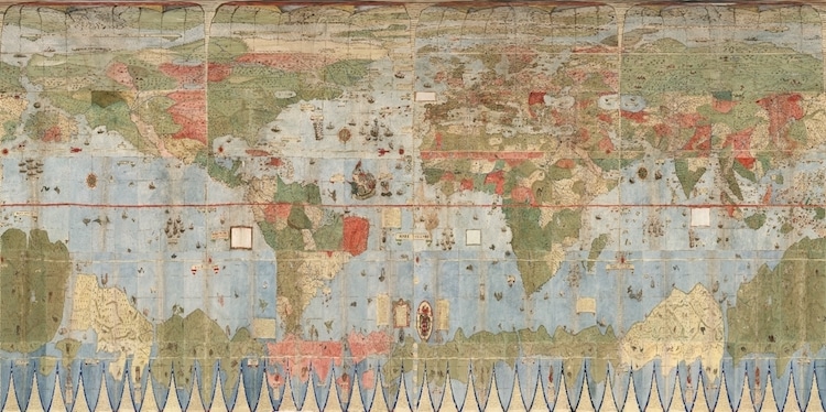
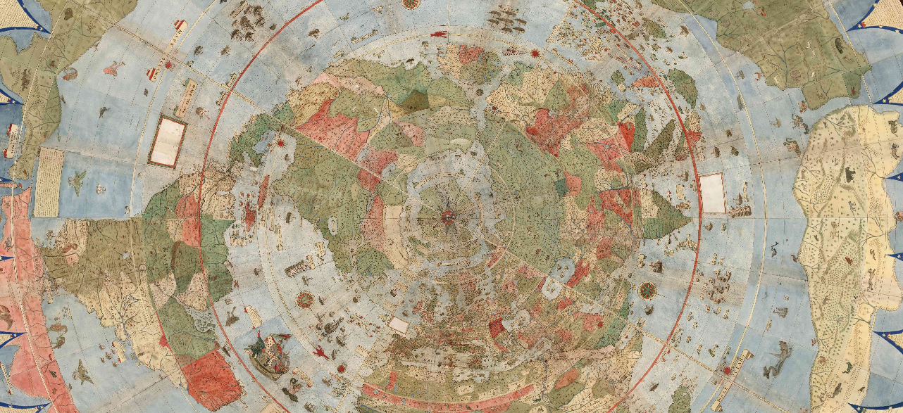
Cartography expert David Rumsey, together with his nephew, painstakingly joined together one of the world’s largest maps for the first time. For over 400 years, Urbano Monte’s color world map was spread out over 60 individual pages. Created just 95 years after the discovery of America, the 1587 rendering is one of the earliest world maps; and when placed together, it stretches out a little over 10 feet.
By digitally joining together Monte’s hand-drawn sheets, it’s even easier to appreciate the incredible details of the historical map. “Monte’s map reminds us of why historical maps are so important as primary resources: the north polar azimuthal projection of his planisphere uses the advanced scientific ideas of his time; the artistry in drawing and decorating the map embodies design at the highest level,” writes Rumsey. “And the view of the world then gives us a deep historical resource with the listing of places, the shape of spaces, and the commentary interwoven into the map. Science, art, and history all in one document.